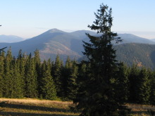
Gorgany is considered to be the wildest area in the whole Carpathian Mountains. It is well-known with its untouched nature, unspoiled environment and steep stony slopes. These all make the trekking across this Carpathian region full of various experiences, challenges, and feelings.
The offered trek includes almost all the highest ridges and peaks of this region. You have to be ready to experience the wading through the dense pine overgrowths; climbing on the steep peaks and hiking by the slopes, formed with rocks, sandstone, and strewn with boulders.
Learn how to: organize a self-sustained expedition, survive without civilization, cook on real open fire, improve the menu with wild food e.g. mushrooms, fish, and berries, choose and organize a good wild camp site, not to get lost.
Total distance to walk: 144 km
Transport: bus / train
Start/finish: Myslivka village / Tatariv village
Itinerary:
 Day 1
Day 1
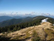
Myslivka village – Malyi Pustoshak Mountain (1313 m) – Velykyi Pustoshak (1423 m) – Nimetska pasture. Our trek is starting from the Myslivka village. Today we have to hike the Velykyi Pustoshak mountain (1423 m) – the peak of the regular shape, almost all covered with the forest. Overfall of the height: 1166 m. Short characteristic of the day route: about 5 km by the well-marked dirt road and path.
 Day 2
Day 2
Nimetska pasture – Horhan Ilemskyi mountain (1587 m) – Mshana pasture – Yaiko Ilemske mountain (1680 m) – Pohanets mountain (1668) – Syvania Lolynska (1642) – Solotvynka pasture. From the overnight place on the pasture wehave to get to the Horhan Ilemskyi mountain. Then we hike toYaikoIlemskyi mountain. After reaching almost the end of the ridge via the several peaks, we descend to Solotvynka pasture.
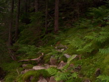 From the overnight place on the pasture we have to get to the Horhan Ilemskyi mountain. Then we hike to Yaiko Ilemskyi mountain. After reaching almost the end of the ridge via the several peaks, we descend to Solotvynka pasture.
Overfall of the height: 1926 m.
Short characteristic of the day route: the well-marked path.
 Day 3
Day 3
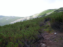
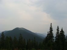
Solotvynka pasture – Moloda mountain (1724 m) – Hrofetskyi pond – Hrofa mountain (1748 m) – Plistse pasture. Long day of trekking Moloda and Hrofa mountains. The ascent from the Hrofetskyi pond to Hrofa mountain is quite gradual. Right after reaching the top, we will descend to the pasture Plistse, quite popular place to stay overnight among the tourists. Overfall of the height: 2082 m. Short characteristic of the day route: the well-marked path.
 Day 4
Day 4
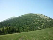
Plistste pasture – Parenky mountain (1736 m) – Popadia mountain (1741 m) – Koretvyna mountain (1671 m) – Petros river – Osmoloda. Today the trekking day is one of the easiest, as we have only to go along the ridge and slope to the Limnytsia river via the Koretvyna Mountain. We can rest on the banks on the river and go to the closest village Osmoloda to buy some food if there is a lack of it.
 We can have a festive dinner – cook the trout on fire. In case, if the weather is bad we can stay overnight in the hunting huts.
Overfall of the height: 1408 m.
Short characteristic of the day route: the well-marked path.
 Day 5
Day 5
Osmoloda– Matahiv ridge – Ihrovets Mountain (1804 m) – Pohar pasture
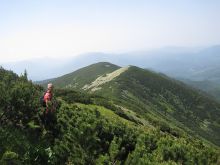
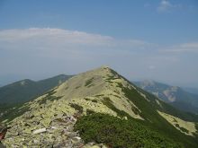
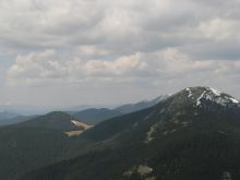
It will be a long day ascenting to the Ihrovets mountain. Be prepared to get a bit tired this day. You will be a witness of the marvelous views on the whole Carpathians from the main ridge of this area. More than that, you can watch the remains of the tranches since World War 1. That will definitely the day full of various feelings.
 We are supposed to stay overnight on the pasture that has enough wood and water.
Overfall of the height: 1355 m.
Short characteristic of the day route: the well-marked path along the ridge.
 Day 6
Day 6
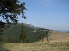
Pohar pasture – Borevka mountain (1596 m) – Lopushna mountain (1695 m) – Syvulia mountain (1836 m) – Rushchyna pasture. One more trekking day will be not so difficult but a picturesque one via the several peaks of the ridge (the highest in Gorgany). We will stay overnight on the pasture Rushchyna.
Overfall of the height: 1127 m. Short characteristic of the day route: the well-marked path;
 Day 7
Day 7
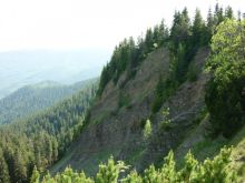
Rushchyna pasture – Peklo stow Tavpishyrka ridge – Bystrytsia village. Today we are hiking to the Bystrytsia village via the stow Peklo the Tavpishyrka ridge. The stow Peklo is a famous place among the hikers with its steep slopes and rocks, which looks quite severe in a fog. The Tavpishyrka ridge will open you the great views on Gorgany if you are lucky with the weather. A part of the trekking route of this day is going through the village Bystrytsia.
 Distance to walk:
Overfall of the height: 975 m.
Short characteristic of the day route: the well-marked path
 Day 8
Day 8
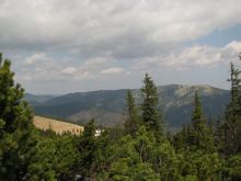
Bystrytsia village – Vedmezhyk mountain (1736 m) – Dovbushanka mountain (1755 m) – Zubrynka river. From the village we are going along the dirt road, then along the path, which take a steep ascent and flows straight to the top of the Vedmezhyk Mountain. After reaching the first peak, the path is going along the ridge and finally we summit the highest peak of the ridge – Dovbushanka mountain (1775 m)
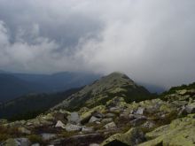 and then descend by the steep slope to our camping place on the picturesque meadow.
Overfall of the height: 1750 m.
Short characteristic of the day route: the well-marked path along the ridge.
Day 9
Zubrynka river – Malyi Horhan mountain (1592,5) – Syniak mountain (1665 m) – Khomiakiv pasture – Khomiak mountain (1542 m) – Tatariv village.
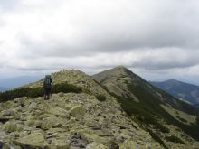 It is the final day of the trek and today we will climb next three peaks of the ridge: Malyi Gorgan, Syniak and Khomiak Mountains. We will not loose the height. That is why we will watch great views almost during the all route for today.
We will just slope to the Tatariv village via the Zhenets waterfall.
Overall of the height: 2023 m.
Short characteristic of the day route: the well-marked path
Tour price is being calculated individually depending on the number of the persons who want join the trek.
The tour cost is being calculated individually and it will include:
- transportation from Lviv to the Carpathians and back by mini-bus;
- food during the trip;
- guide fee;
- insurance.
To reserve the tour please send an e-mail to carpathians@inlviv.com, specifying:
- your name and surname, country;
- how many people you are;
- contact phone number and e-mail;
- the name of the tour;
- starting date,
Please, check what to take with you on a mountain trip.
The tour starts from Lviv, but alternative pick up places could be arranged.
We could offer you to stay a few days after the tour in Lviv. And here you can find information about the hotels, apartments and hostels.

